Chart of Newfoundland and the fishing banks in 1693
Item
-
Title
-
Chart of Newfoundland and the fishing banks in 1693
-
Description
-
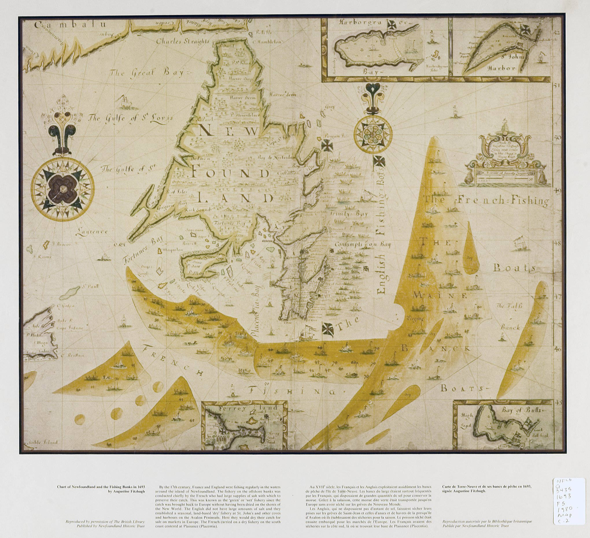
A chart from 1693 that shows Newfoundland and its surrounding fishing areas, including zones used by English and French fishermen. It highlights the importance of the Grand Banks and European competition for resources.
-
Creator
-
Fitzhugh, Augustine, fl.1683-1694
-
Source
-
Fitzhugh, Augustine. Chart of Newfoundland and the fishing banks in 1693. Memorial University Digital Archives. Accessed April 2026. https://collections.mun.ca/digital/collection/maps/id/74/rec/1
-
Permalink
-
Publisher
-
MacEwan University Library
-
Date
-
1693
-
Format
-
JPEG; 2040 x 1860 pixels
-
Language
-
eng
-
fre
-
Subject
-
North Atlantic Ocean--Maps--Early works to 1800; Newfoundland and Labrador--Maps--Early works to 1800; Cartography -- Canada -- History; Canada -- Historical geography -- Maps
-
Type
-
Still image