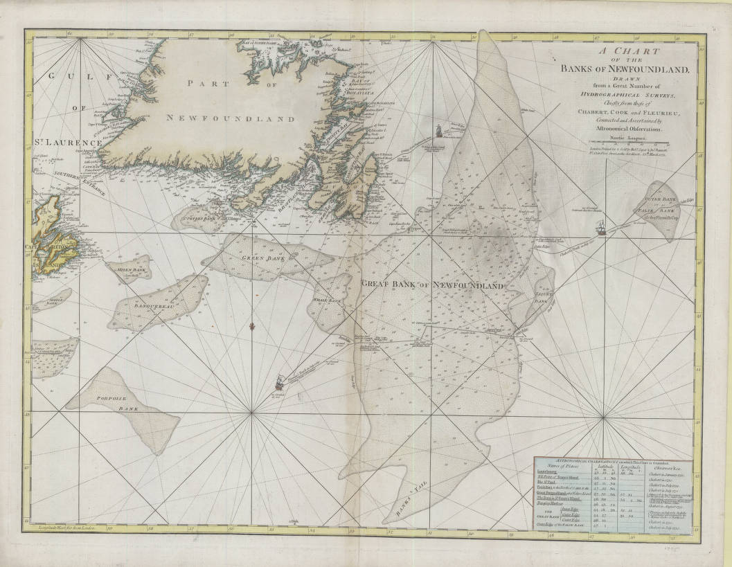
A chart of the Banks of Newfoundland
Item
-
Title
-
A chart of the Banks of Newfoundland
-
Description
-
This chart shows the waters around Newfoundland, including the Grand Banks and navigation routes. It includes a labeled route of a ship traveling from England to St. John’s in 1746.
-
Creator
-
Cook, James, 1762-1775
-
Chabert
-
Fleurieu
-
Source
-
A chart of the Banks of Newfoundland. 1775. Memorial University Digital Archives Initiative. Accessed April 2026. https://collections.mun.ca/digital/collection/maps/id/888/rec/25
-
Permalink
-
Publisher
-
MacEwan University Library
-
Date
-
1775
-
Format
-
JPEG; 800 x 620 pixels
-
Language
-
eng
-
Type
-
Still image
-
Subject
-
North Atlantic Ocean--Maps--Early works to 1800; Newfoundland and Labrador--Maps--Early works to 1800; Cartography -- Canada -- History; Canada -- Historical geography -- Maps