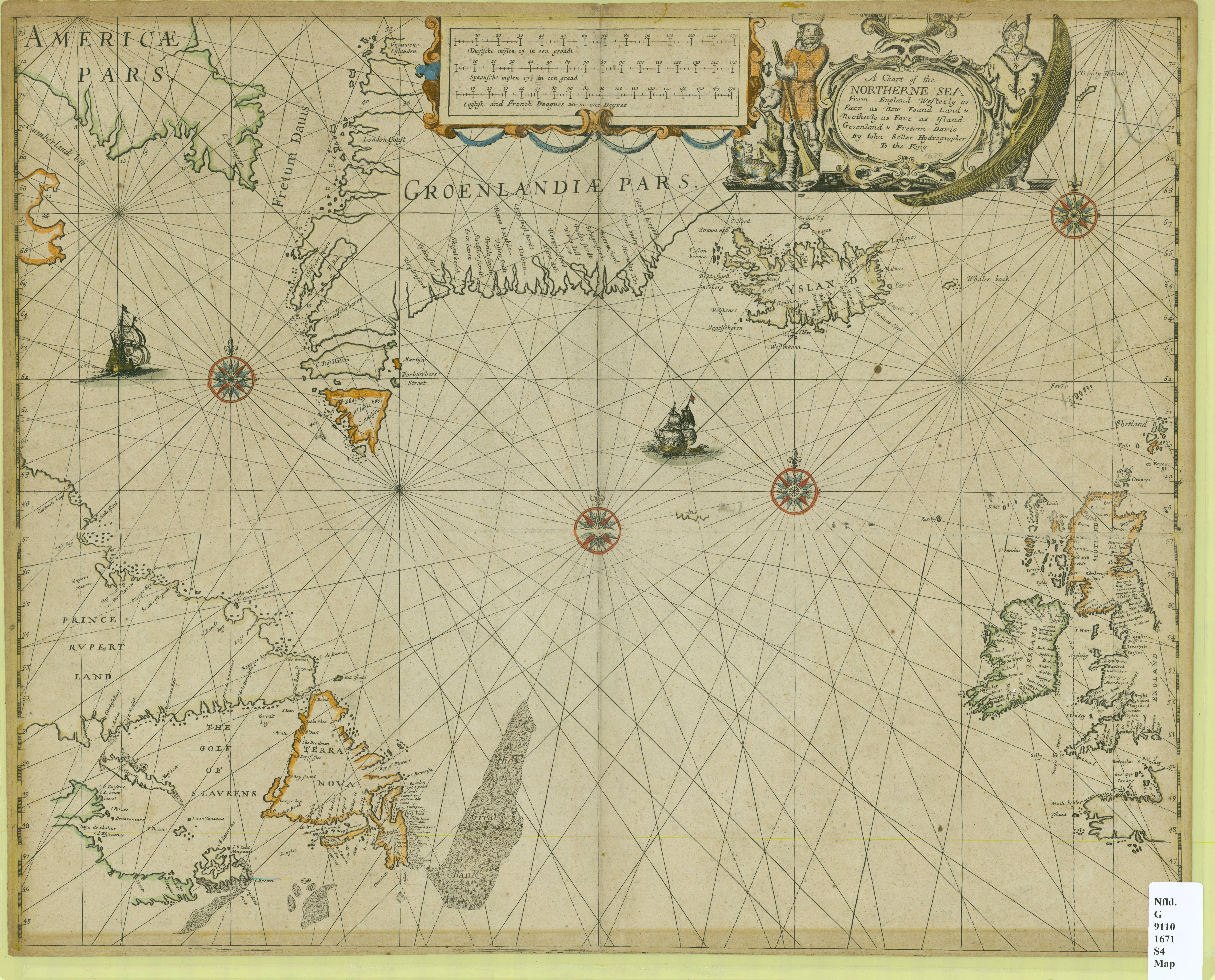
A chart of the northerne sea, from England westerly as farr as New Found Land and northerly as farr as Island Groenland and Fretum Davis
Item
-
Title
-
A chart of the northerne sea, from England westerly as farr as New Found Land and northerly as farr as Island Groenland and Fretum Davis
-
Description
-
Hand coloured. Four compass roses with rhumb lines. Decorate title cartouche. Decorative cartouche with bar scales in English and French leagues, Spanish leagues and German leagues. Shows underwater features.
-
Creator
-
Seller, John, fl. 1658-1698
-
Source
-
John Seller. A chart of the northerne sea, from England westerly as farr as New Found Land and northerly as farr as Island Groenland and Fretum Davis. 1671. Memorial University Digital Archives. Accessed April 2026. https://collections.mun.ca/digital/collection/maps/id/313/rec/34.
-
Permalink
-
Publisher
-
MacEwan University Library
-
Date
-
1671
-
Format
-
JPEG; 800 x 646 pixels
-
Language
-
eng
-
dut
-
Type
-
Still image
-
Subject
-
North Atlantic Ocean--Maps--Early works to 1800; Newfoundland and Labrador--Maps--Early works to 1800; Cartography -- Canada -- History; Canada -- Historical geography -- Maps
-
Identifier
-
G 9110 1671 S4 MAP